The United Nations General Assembly has backed a new approach to world maps that gives students and the wider public a more accurate picture of Africa’s true size.
The resolution, led by Togo and supported by African Union member states, promotes the use of the Equal Earth map projection as an alternative to the widely used Mercator projection. It was adopted on 4 September 2026 by 164 votes to one, with six abstentions.
For schools, geography teachers and students, the decision offers an opportunity to explore how maps influence the way people understand the world.
Why Africa’s True Size Matters In Education
Maps are among the first tools children use to understand geography.
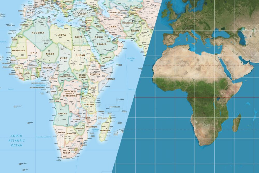
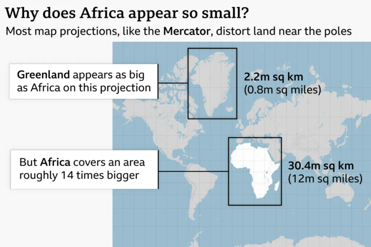
However, the familiar Mercator projection does not show the relative size of continents accurately. It makes areas closer to the poles appear much larger than they are, while regions around the equator appear smaller.
As a result, Greenland can appear similar in size to Africa on a traditional Mercator map. In reality, Africa covers about 30.4 million square kilometres, while Greenland covers about 2.2 million square kilometres. Africa is therefore roughly 14 times larger.
The distortion is a consequence of trying to represent the surface of a globe on a flat map. No two-dimensional map can preserve every geographical property perfectly.
For educators, this provides a useful classroom opportunity. Students can compare different map projections and consider how choices about shape, size, distance and direction affect their understanding of geography.
What Is The Mercator Projection?
The Mercator projection was created by Flemish cartographer Gerardus Mercator in 1569. It was designed primarily to support navigation because it preserves directions in a way that made it particularly useful for sailors.
However, it significantly increases the apparent size of regions closer to the North and South Poles.
This means countries and continents in tropical and equatorial regions can appear smaller than their actual land area.
The issue has attracted growing attention because maps are not simply geographical tools. They can also influence how people perceive the importance and position of different regions.
Togolese Foreign Minister Robert Dussey said,
“A fair world begins with a fair map. A map is never neutral. It shapes perceptions, influences how the place of peoples and continents in the world is understood.”
Equal Earth Offers A Different View
In 2018, cartographers developed the Equal Earth projection to show the relative areas of continents more accurately while retaining a recognisable world map.
In February, the African Union’s 54 member states adopted the projection and said it “more accurately represents the sizes of all continents, particularly Africa”.
The UN resolution now gives further international attention to the projection. However, it does not mean that the Mercator projection will disappear from every map or navigation system.
The resolution is non-binding and specifically supports more accurate representations of the relative size of the world’s regions. Mercator remains useful for navigation, where its properties are particularly suited to showing direction.
What Students Can Learn From The Map Debate
The discussion provides geography teachers with more than a lesson about Africa’s true size.
It can help students understand that maps are created for different purposes. Some prioritise accurate area, while others focus on direction, distance or shape.
For example, students could compare the Mercator and Equal Earth projections and identify how Africa, Europe, North America and Greenland change in appearance.
They can then discuss why no single flat map can represent the Earth perfectly.
This can also introduce wider lessons about critical thinking and visual information. Students can learn to question what they see, understand how information is presented and consider why a particular representation was chosen.
For schools, the topic could therefore support geography, social studies and media literacy lessons.
A Wider Conversation About Representation
The campaign behind the UN resolution argues that the way Africa is represented on maps can affect how the continent is perceived.
Online campaign group #CorrectTheMap said,
“You could fit the United States, China, India, Japan, Mexico and much of Europe into Africa and still have land to spare.”
Lerato Mogoatlhe from Africa No Filter, one of the groups behind the campaign to ditch the Mercator map said,
“Africa’s misrepresentation on world maps is not just a cartographic error, it’s a narrative issue,”
She described the campaign as part of efforts to stop the “world’s longest misinformation and disinformation” about Africa.
Kenyan geographer Kioko Muendo also told the BBC that the way Africa is shown can influence perceptions of its resources, population and investment opportunities. He said,
“Maps are more than just guides for travellers, they shape how regions are perceived politically and economically.”
France And The United States Take Different Positions
The proposal received support from France. French Foreign Minister Jean-Noël Barrot said his ministry would stop using the Mercator projection. He said that changing the map doesn’t change the world, but correcting a representation that distorts it is already an act of truth.
The United States, meanwhile, was the only country to vote against the resolution. US representative Yaryna Ferencevych criticised the initiative during the UN debate. She said that instead of focusing on genuine problems of international peace, prosperity, or good relations, this body is debating map projects from the 16th Century, and their role in promoting reparations and ‘cognitive justice.
The UN vote was therefore not simply a debate about cartography. It also highlighted different views about representation, education and the role of international organisations.
Why The Decision Matters For Schools
For students, seeing Africa at a more accurate scale can strengthen geographical understanding and provide a useful reminder that visual representations are not always neutral.
The change also gives educators an opportunity to move beyond memorising countries and capitals. Students can explore how maps are designed, why different projections exist and how geographical information can shape perceptions.
Ultimately, the debate around Africa’s true size offers a practical lesson in critical thinking.
A world map may look familiar, but understanding how it was created can change the way students see the world.